Highway 169 Reconstruction
An easy-to-use interactive map to help make sense of a highly disruptive construction project
Design: Interactive Mapping, UI/UX, Web Design and Development
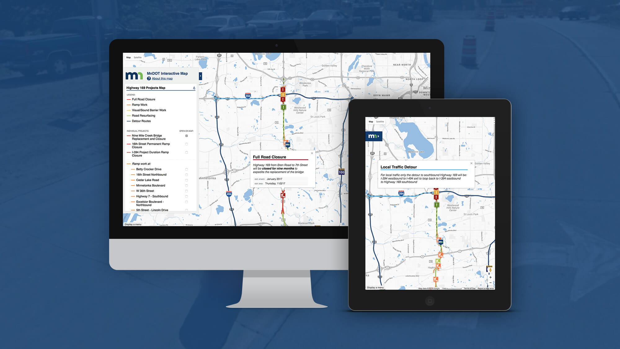
The public needed to stay informed about a substantial nine-month construction project. I worked on illustrative maps and diagrams and also helped launch MnDOT’s first accessible interactive online map. This map was used by more than 70,000 people and received first place and a best of show nomination from the MN Association of Government Communicators 2017 Northern Lights Awards.
- Google Maps JavaScript API
- Raw GIS data
- GeoJSON code
Emphasis on accessibility
—
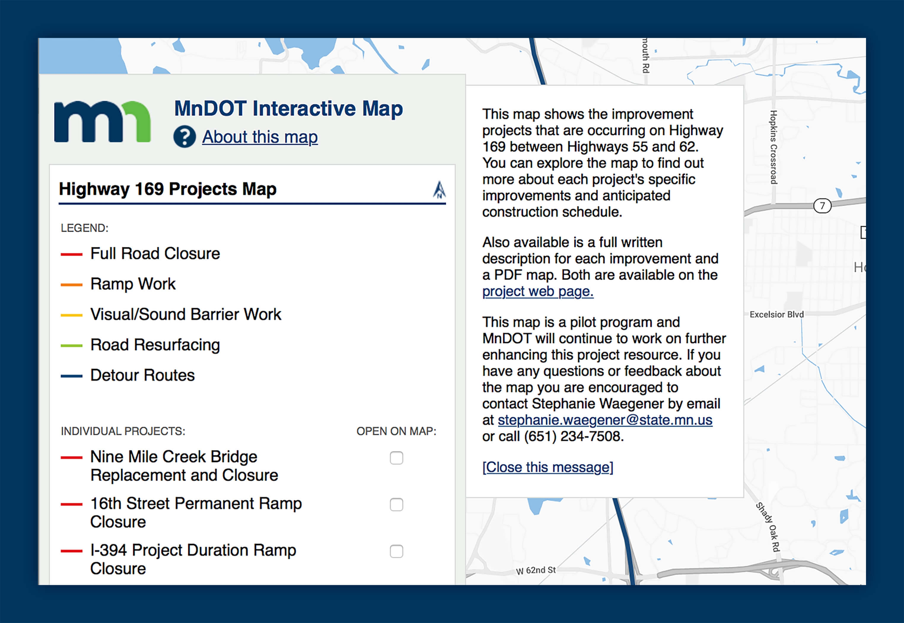
MnDOT had never before used an interactive map, because none met their base accessibility needs. I researched and implemented several methods to increase the accessibility of the tool and helped MnDOT develop additional standards. It was extremely rewarding to launch!
Alternative Formats
The simplest way to make sure the map was useable was to provide additional text and image versions of the relevant information. Keeping PDF and plaintext versions up to date allowed us to share more information with an even larger audience.
Keyboard Navigation
While a Google Map is familiar to many users, those tools are not always initially accessible. This map used a specific tab index and custom JavaScript functions to work as intended without needing to use a mouse.
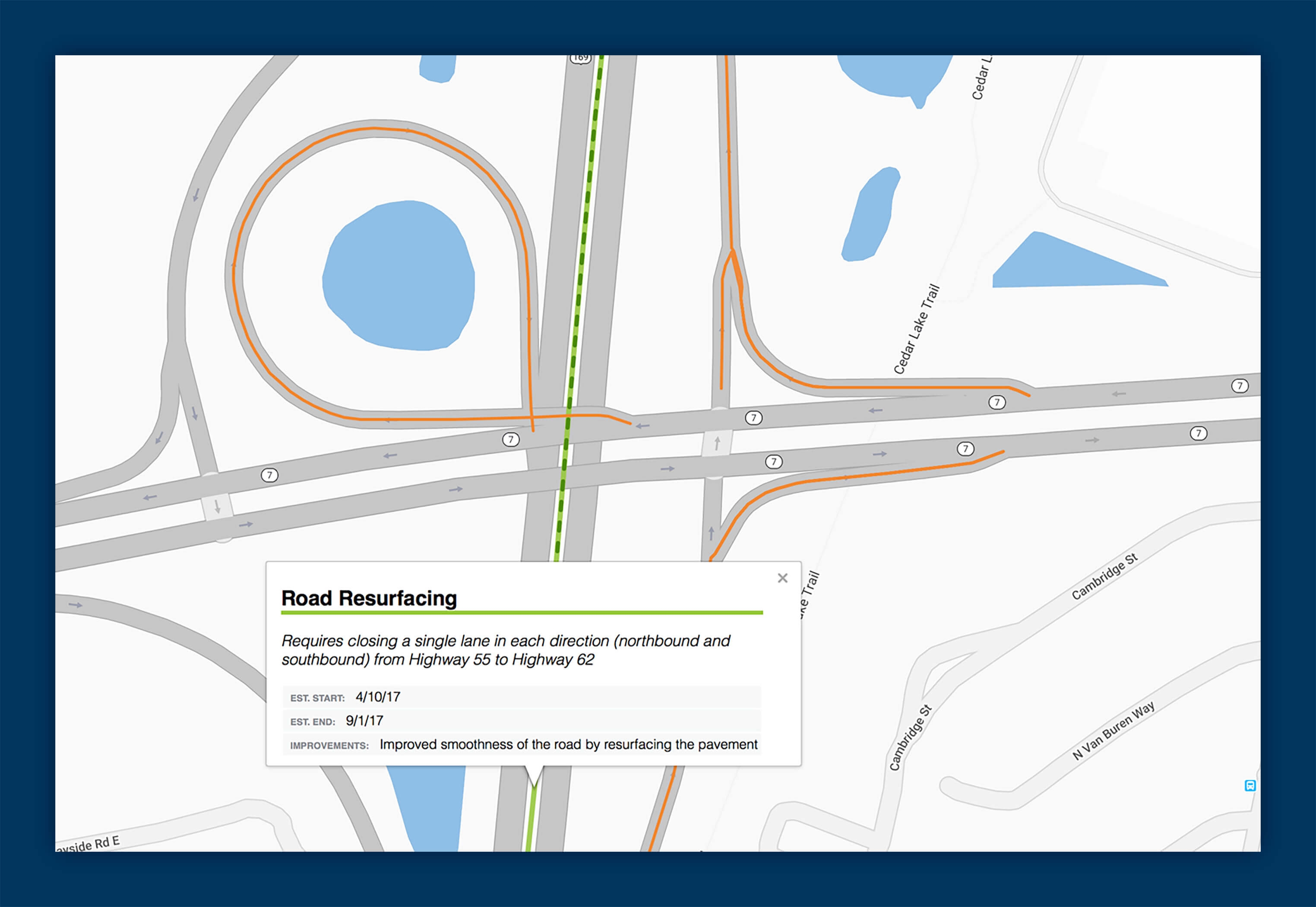
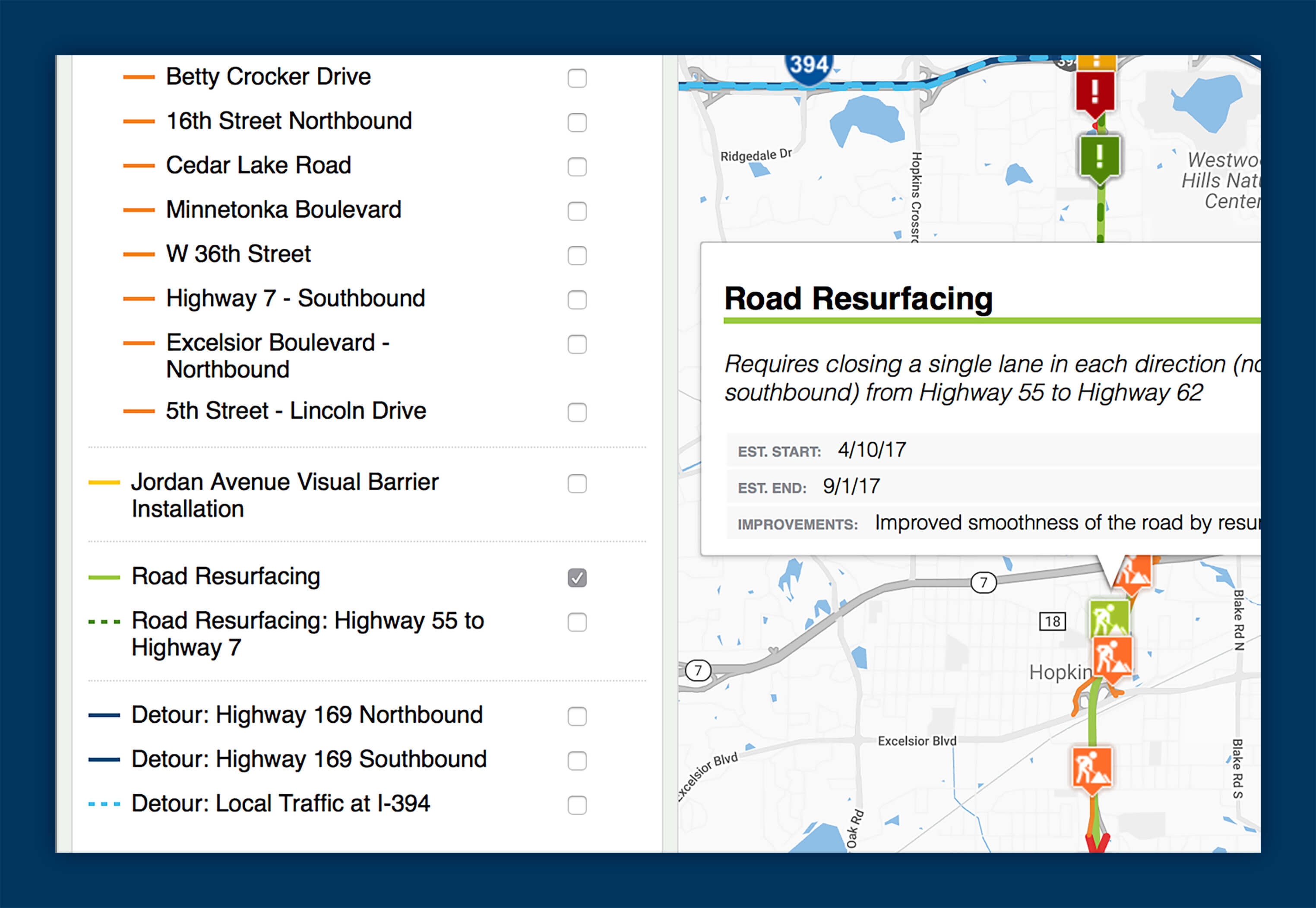
Detailed Data and Information
This map let people explore the way road closures and construction improvements would affect their neighborhoods and streets. By showing them exactly how their travels would be impacted we were able to make this project easier to manage and understand.